Day 65,
Fri, 3/3: Morning hours were taken by cleaning and
last minute shopping. Had a BBQ at our
place with our golf friends, Tom and Cheryl Rodewald and Jerry and Judy
Karwhite. Burgers, beans, salad and
Tiramisu. Wow! Good food and better company.
Day 66,
Sat, 3/4: Another day to visit friends from
home. Lauren and Nora were down visiting
family in Case Grande (between Phoenix and Tucson) so we met them half way for
lunch at Ocotillo Golf Resort. It was a
nice warm day and we sat out on the patio overlooking the golf course. What a fun visit.

 On the way home we decided to do some exploring. We stopped at the Wrigley Mansion (yup, the chewing gum magnate). William Wrigley, Jr built the landmark building between 1929 and 1931 at a cost of $1.2 million. It was a compilation of many architectural styles, but strongly Spanish Colonial, as reflected in the extensive use of tile throughout. The mansion sits atop a 100 foot hill that overlooks greater Phoenix and the Arizona Biltmore Hotel, which Wrigley also owned. The Phoenix mansion was just one of 7 residences owned by the Wrigleys, but the smallest and only used a few weeks a year. William Wrigley died in 1932, shortly after its completion. In 1992 Geordie Hormel (of Hormel Foods family) purchased the mansion and turned it into an event venue for meetings, conventions and weddings. He was a musician and recording studio proprietor, so the facility was frequently used. Due to zoning regulation, The Wrigley Mansion operates as a private club (more on that later). Though not particularly elaborate on the outside, the mansion is quite opulent inside with inlay wood ceilings, personalized tiles (Mr. Wrigley had his own tile company), hand carved doors, handmade tapestries and crystal chandeliers. There are pictures throughout of Hollywood Stars and political celebrities being entertained at the mansion. It must have been quite a place to be seen in it's day. We got there late enough in the day that we missed the last organized tour. We were told that for $5.00 each we could walk through the mansion on our own or if we'd rather, we could purchase a drink from the bar and wander the mansion with drink in hand (the advantages of a private club). Off we went to the bar. We got there just as there was a bartender shift change. We started chatting with the retiring bartender as he poured our wine and before you know it he said "follow me" and proceeded to give us a personalized tour of the mansion (pretty sweet deal). We even saw the old switchboard for the mansion that was wallpapered in gum wrappers. There was a wedding getting started as we left, so we skirted around the edges of the lawn to get back to the car. Pretty interesting place.
 |
| Front Door |
 |
| Front Door |
 |
| Ballroom Ceiling |
 |
| Entry Staircase |
 |
| Ladies Room Brocade Wallpaper |
 |
| Ladies Room |
 |
| Ladies Room Light |
 |
| Personalized Floor Tile |
 |
| Switchboard |
 |
| Breakfast Room |
Day 67,
Sun, 3/5: Moving day!! We weren’t moving very far this trip…just to
a different site at Pueblo El Mirage. We
had originally planned to leave for Tucson on Sunday, 3/5. Bill Hilton from Trilogy puts together a golf
outing every year for all the Trilogy folks wintering in Arizona. We didn’t find out the date of the tournament
until we’d already made our travel plans.
We really wanted to play with this group on 3/8, so got creative and
proceeded to change all our plans.
First, I stopped at the front desk at El Mirage to see if there was any
wild chance we could stay here 4 more nights.
She said she'd just checked for someone else and they were totally booked, but she checked again anyway. She couldn’t believe it and checked and
double-checked. There was one spot open
for the exact 4 nights we needed. I told her I was going to rush out a purchase a lottery ticket. Ta
da! One step down. Next, we called the RV resort in Tucson to
see about changing our arrival and departure dates there. That worked!
We did have to cancel our plans to stop in Yuma for a few nights because
we couldn’t change our reservations at Lake Havasu. All-in-all, everything worked out. So anyway….we moved from space 1188 to space
664 mid-morning. Spent the afternoon at
the clubhouse (Wi-Fi) getting the blog out.
Early to bed (see tomorrow).
Day 68,
Mon, 3/6: The alarm went off at 3am 😒. Dave’s travel day. He decided that he wanted to get more advice
about the issues with his shoulder. His
doctor gave him a referral for an orthopedic physician and x-rays for Monday
afternoon at Bellevue Group Health. His
flight was at 6:10am. Appointment at
3:30pm. Return flight at 8:20pm. We’d originally planned for me to take him to
the airport and pick him up. I decided I
didn’t need the car for one day, so off he went at 3:15am. It snowed in Seattle on Sunday, so he was
expecting either more snow or rain.
Luckily it was just rain, but just above freezing. Pretty handy to have that down jacket along
on this trip because the wind was pretty biting. Dave had researched the bus schedules from
SeaTac to Bellevue and back and with a whole day to spend, the bus was a good
transportation option for $2.50. Even though his
appointment wasn’t until 3:30pm, he went immediately to Group Health (now
Kaiser) to see if he could get in earlier.
He was told nothing was open. He
went to meet son Sean for lunch. After
lunch he went back to Group Health, checked in and proceeded to wait. It’s only about 1pm and he said he hadn’t
been sitting there long when the nurse called him in for x-rays. After, he thought he was going back out to
wait in the lobby for his appointment, but she said “no” he would be seeing the
orthopedic physician now. Good
exam. Looks like a detached rotator
cuff. Next exam was scheduled with an
orthopedic surgeon for early April. Need
to have an MRI done and then the surgeon will determine if surgery or not. Back to the airport with enough time to make
an earlier flight back to Phoenix. Still
didn’t get back to the motorcoach until close to midnight. Reeeaally long day, but well worth it!
Day 69,
Tue, 3/7: Lazy morning. Ran some errands before meeting friends Jerry
and Judy Karwhite at their motorcoach for dinner. Judy made a wonderful chicken and mushroom
dish in one of her 2 crockpots. Mashed
potatoes were in the other crockpot….all cooking outside. Love cooking in my crockpot (I only have 1). I’m going to have to try this cooking outside
thing. Wonderful dinner and visit (oops, forgot to take a picture).
 Day 70,
Wed, 3/8: Today was the fun day that made us alter
our travel plans. This was the Bill Hilton golf tournament
for all the folks from Trilogy that winter in Arizona. We played a private Sun City course in west
Sun City called Corte Bella. A beautiful
course with wide fairways, virtually no water, and lots and lots of
bunkers.
Day 70,
Wed, 3/8: Today was the fun day that made us alter
our travel plans. This was the Bill Hilton golf tournament
for all the folks from Trilogy that winter in Arizona. We played a private Sun City course in west
Sun City called Corte Bella. A beautiful
course with wide fairways, virtually no water, and lots and lots of
bunkers.
We played a scramble with about
32 players, so we all got back to the clubhouse for lunch at about the same
time. Dave and I were paired up with our
friends Gary and Deb VanWieringen. We
really had fun. Didn’t win any money,
but we were close.
 Day 71,
Thu, 3/9: Moving day! South to Voyager RV Resort in south Tucson. We hadn’t stayed at Voyager before, but had
friends that did. Thought we’d try it
out. Hmmm….not nearly as nice as the
park in Phoenix. It was not anywhere
near full, but for whatever reason, we got a space with neighbors all around. It was a good sized space with plenty of room
to put out the slides, a concrete pad with gravel surround to park the car
alongside.
Day 71,
Thu, 3/9: Moving day! South to Voyager RV Resort in south Tucson. We hadn’t stayed at Voyager before, but had
friends that did. Thought we’d try it
out. Hmmm….not nearly as nice as the
park in Phoenix. It was not anywhere
near full, but for whatever reason, we got a space with neighbors all around. It was a good sized space with plenty of room
to put out the slides, a concrete pad with gravel surround to park the car
alongside.
The major complaint was that
there was not a tree, shrub or blade of grass in site….only gravel. With temps in the 90s, and the direction we were facing, there was no help for
shade except for what we could create with our coach or the neighbors. So far, not my favorite RV Resort. Oh yah…and there’s no WiFi at the sites, only
in 3 designated areas. I guess I can
live with that because that’s the same setup we had in Phoenix. They did have a restaurant onsite, so we took
our hot sweaty bodies over there for dinner.
Day 72,
Fri, 3/10: Today was a leisurely day. Decided we’d head over to one of the WiFi
areas and catch up on email. We went to
the courtyard. It was way too hot and no
shade. We got a shady spot at the pool,
but the WiFi was so poor I couldn’t get a strong enough signal to populate the
photos in my email (I subscribe to a lot of sewing, quilting, knitting and doll
making blogs and suppliers and I need to see the photos). Dave stayed at the pool reading a magazine
and I headed to the third and last option for WiFi….a dedicated WiFi room. This room was very small with 7 tables that
sat 2 each. Not very much room for an RV
park this size. Anyway, I did get a
stronger signal here to at least clean out my mailbox some. Not very speedy WiFi, but at least it did
work. Back to the coach for dinner.
Day 73,
Sat, 3/11: Late afternoon, we headed up to La Paloma Golf
Resort to explore and have a glass of wine.
Situated at the base of the Santa Catalina Mountains on the east edge of
Tucson, Westin has a beautiful hotel on this famous golf course. We sat on the back patio overlooking the 18th
green, but it was almost too hot with no umbrellas for shade and the sun
setting in our eyes (couldn't even get a good picture).
After our wine, we
headed to downtown Tucson. The 2nd
Saturday of the month, Tucson closes down some of the downtown streets in the
evening and has food trucks and live music so we decided to go see what it was
all about. We parked in a downtown
garage for $5 (can you believe only $5?) and joined the crowds of people
wandering the streets. We each picked a
different food truck and then sat down to listen to some of the musicians. It was a pretty eclectic mix of music and the
performers were scattered across a few blocks.
Seemed like there was an shop or food truck selling ice cream on every
corner. We were stuffed, so didn’t give
into the temptation for ice cream. Great
people watching!!
 |
| Street Mime |


 Day 74,
Sun, 3/12: Our trek today was to Sabino Canyon for
a little hiking in the desert. Today was
the hottest day yet and we got a late start.
We got to the park entrance about 9:30 and the main parking lot was
already full (not sure what we were thinking…we’re retired…should be doing this
on a weekday). We went to overflow
parking and hiked ¼ mile on a dirt trail to the main trail/road. The park service offeres a 45-minute, 3.8
mile narrated tram tour from the Visitors Center. The tram makes 9 stops along the tour at
various trailheads and turns around at stop #9, heading back to the Visitors
Center. Many people take the tram to the
end and hike back down the paved road to the Visitors Center. Of course, the trail we took from the parking
lot did not drop us at the Visitors Center, but part way up the road. We weren’t expecting a hike on a paved road,
but it was hot and we decided with the heat, we probably weren’t going very far
anyway.
Day 74,
Sun, 3/12: Our trek today was to Sabino Canyon for
a little hiking in the desert. Today was
the hottest day yet and we got a late start.
We got to the park entrance about 9:30 and the main parking lot was
already full (not sure what we were thinking…we’re retired…should be doing this
on a weekday). We went to overflow
parking and hiked ¼ mile on a dirt trail to the main trail/road. The park service offeres a 45-minute, 3.8
mile narrated tram tour from the Visitors Center. The tram makes 9 stops along the tour at
various trailheads and turns around at stop #9, heading back to the Visitors
Center. Many people take the tram to the
end and hike back down the paved road to the Visitors Center. Of course, the trail we took from the parking
lot did not drop us at the Visitors Center, but part way up the road. We weren’t expecting a hike on a paved road,
but it was hot and we decided with the heat, we probably weren’t going very far
anyway.
 |
| The only blooming cactus |
 The road followed the Sabino
River and there were spots you could hike down to the river for a shady
detour. At various points along the
route were easy to challenging trailheads off into the desert. The main road was all paved, 2,000 to 3,300
feet elevation and crossed Sabino Canyon over 9 stone bridges. We walked the trail for about an hour and
turned around and headed back to the parking lot before melting. It was really getting hot quickly (90+ degrees). Found a great little lunch place called Bread
and More for lunch, stopped for groceries and headed home to hit the pool.
The road followed the Sabino
River and there were spots you could hike down to the river for a shady
detour. At various points along the
route were easy to challenging trailheads off into the desert. The main road was all paved, 2,000 to 3,300
feet elevation and crossed Sabino Canyon over 9 stone bridges. We walked the trail for about an hour and
turned around and headed back to the parking lot before melting. It was really getting hot quickly (90+ degrees). Found a great little lunch place called Bread
and More for lunch, stopped for groceries and headed home to hit the pool.
 |
| Sabino River over bridge |
 |
| Ocotillo bout to bloom |
 Day 75,
Mon, 3/13: Before we left, I discovered through one of my art sites that the city of Tucson had a city-wide mural display. Sounded like a wonderful way to spend the day. The City of Tucson started a pilot program in
2016 called the City of Tucson Mural Program.
The program was created to beautify blighted areas, strengthen the local
culture, and provide a visually friendly environment for residents and visitors. The initial funding for the program came from a generous $50,000 grant from the Tohno O'odham Nation. Additional funds were donated by local
businesses and individuals to create murals that reflect diversity in
style and culture and artists from diverse backgrounds were encouraged to
apply. Today the City of Tucson Mural
Program consists of over 500 murals across north, central and south Tucson
created by local artists. The 7 map areas have diagrammed and listed the address of each mural (tucsonmurals.org). After I printed each of the maps, it was pretty clear that we would only be viewing a small fraction of the murals. They are spread out all over the city. It was going to be another 90+ day, so we started out early. We began our tour by starting on the south edge of downtown and trying to view the murals by car. That didn't work because many of the murals are on the side or back of buildings. Some buildings didn't have noticeable addresses on them. We quickly gave up that plan and selected a number of murals in the downtown core, parked and headed out on foot.
Day 75,
Mon, 3/13: Before we left, I discovered through one of my art sites that the city of Tucson had a city-wide mural display. Sounded like a wonderful way to spend the day. The City of Tucson started a pilot program in
2016 called the City of Tucson Mural Program.
The program was created to beautify blighted areas, strengthen the local
culture, and provide a visually friendly environment for residents and visitors. The initial funding for the program came from a generous $50,000 grant from the Tohno O'odham Nation. Additional funds were donated by local
businesses and individuals to create murals that reflect diversity in
style and culture and artists from diverse backgrounds were encouraged to
apply. Today the City of Tucson Mural
Program consists of over 500 murals across north, central and south Tucson
created by local artists. The 7 map areas have diagrammed and listed the address of each mural (tucsonmurals.org). After I printed each of the maps, it was pretty clear that we would only be viewing a small fraction of the murals. They are spread out all over the city. It was going to be another 90+ day, so we started out early. We began our tour by starting on the south edge of downtown and trying to view the murals by car. That didn't work because many of the murals are on the side or back of buildings. Some buildings didn't have noticeable addresses on them. We quickly gave up that plan and selected a number of murals in the downtown core, parked and headed out on foot.


What an absolutely wonderful outdoor gallery of old building walls, utility structures and public spaces. This program makes art available to everyone and provides a perspective on the different cultures that settled in the Tucson area. The gorgeous colors, beautiful birds, flowers and cactus just scream Southwest. There are some very creative artists here that take pride in revitalizing their town. It was an very enjoyable morning exploring urban art.
Day 76, Tue, 3/14: The Pima Air & Space Museum was on our bucket list for Tucson and it happened to be right up the road from our RV park. We thought we were getting there early by arriving at 10am, but by then all the Bone Yard Tours (the "Graveyard of Planes" is the largest storage and preservation facility in the world) of the day had already sold out. Oh well, next time. The 80 acre museum is one of the world's largest non-government funded aerospace museums. It displays over 300 historical aircraft in both hangars and out on the multiple acres surrounding. Displays start with the Wright Brothers right all the way up to the 787 Dreamliner. We got into the museum just in time to join the first 50 minute docent led walking tour of the Main Hangar-General Aviation. We followed that tour with a second 50 minute tour by the same docent of Hangar 3-WWII. Excellent tours!! While we were standing waiting for the first tour, someone nudged me and I looked over and saw Jerry and Judy Karwhite (one of a just a few coincidences this trip). We'd just seen them in Phoenix a couple days ago and they mentioned that they would be down to do the Pima Air & Space Museum tour, but no mention of what day. What are the odds of running into them on Tuesday?


After our docent ours, we stopped at the cafe for lunch before heading out into 95 degrees. Because it was so hot, we didn't spend a lot of time wandering around the outside aircraft...next time. We did go into the building housing the Space Museum. Having been to Kennedy Space Center in Florida, this was quite a disappointment. It was very small and very dark. The displays were hard to see and even harder to read the placards. It didn't take long to do that museum. We wandered back into the Main Hangar. It was almost closing time, so it wasn't as crowded as it had been earlier so we spent more time there. We were really surprised when we got ready to leave to discover that we'd spent 7 hours here and not seen everything. Off for a cold beer at Barrio Brewery.
Day 77, Wed, 3/15: Is it really going to be 98 degrees today? Can we really play golf in 90 degree heat? Sure hope so 'cause today is a trip to Tubac (the movie Tin Cup with Kevin Costner was filmed here). We've been wanting to play golf here for a few years. Dave's shoulder wasn't feeling great, but he may not play golf again for some time, so golfing we go. We took the back road to the south via Nogales for the scenery. We stopped at the little artists colony in Tubac for a visit and then headed to the resort for lunch.


Our tee time was 2pm...right in the heat of the day. Lucky for us, a cloud cover and breeze picked up that afternoon and kept the temperature. The huge trees did make for a very pretty course. We golfed with a couple wintering from Colorado. We had a really good time and barely made our 18 holes by dark. As the golf book says "worth the drive".
Day 78, Thu, 3/16: We had a leisurely morning and then headed into downtown Tucson to meet Jim and Kathy Parks for dinner. We were planning to see John and Jamie Calhoun as well, but John got sick, so it was just the 4 of us. We met at Maynard's Market in the old train station (actually it is still the train station at the other end of the building) for Happy Hour. It was a nice warm evening and we sat out on the patio. They had good food and wines and the happy hour prices were great. Thanks to Jim and Kathy for recommending this place. We had some good laughs, compared travel stories and got caught up on new and old news. Fun evening!


Day 79, Fri, 3/17: I've never been to a Champions Tour (Sr. PGA Players over 50) tournament before and they were playing at the Omni Tucson National Resort. Because tickets were only available for Fri-Sun, and we're leaving Saturday, today's the day. Unlike the regular PGA tour, this field is only 78 players. They also play a no-cut format with everyone playing all 3 days of competition. Attending the Tucson Conquistadors Classic isn't anything like the crowded PGA tournaments. You could stand next to the players on the tee box or putting green. The players were social and having a good time with the small crowds. Steve Stricker (one of my favs) made his Champions Tour debut today. It was another 95 degree day and there were no covered viewing stands for us peons. It was hot! and we kept as close to shade as we could find. Everyone was doing the same thing, so the shady spots were really crowded😊. We didn't wander near as much as we would normally, and by mid-afternoon we gave up and went home.

P.S. My man Steve Stricker led by 3 shots entering the final round on Sunday. Tom Lehman was second. Fred Couples (from Seattle) was tied for third. Tom Lehman won by one stroke.
Day 80, Sat, 3/18: Today was moving day to Lake Havasu. Many of our RV friends have been here before, so thought we'd try it out. We had reservations at the State Park which is right in downtown (such as it is). We got to our campsite early afternoon. Nice spot with unobstructed view of the lake...water and elec.-no sewer.


We were just sitting outside under our shade tree (it was really hot) admiring our view when a class C motorhome pulled up behind us. I said to Dave, "That looks like Walt and Kathy Timpe" (from our RV Club at Trilogy). Sure enough it was. As Kathy was unhooking the car, we went over and told her she couldn't camp there because we were saving it for our friends (you know how it is when you see someone out of context and you know you know them but they aren't in the right environment?). That was the look on Kathy's face. It took her a minute to realize who we were and that we were just joking. What a coincidence!! Not 15 minutes later here came Bill and Ann Carlstrom (also from our RV Club at Trilogy) camped in the space right behind us (travelling with Timpes). So all three of us were camped in a row. What are the odds of that? They didn't know we would be at Havasu and we didn't know they would be at Havasu. If we had been camped in another part of the park, we might not have even seen them.
 |
That's Carlstrom's rig in the background and we're behind them.
We had the best time!! Kathy's sister was also camped nearby and every evening at 5:30 we'd all grab our chairs and drinks and get together for cocktail hour to visit and tell stories. This happenstance meeting really made this stop special.
Day 81, Sun, 3/19: Off this morning to explore Lake Havasu and the London Bridge. This lake community first started as an Army Air Corps rest camp during World War II. According to local legend, Robert McCulloch first spied the eventual site of what would become Lake Havasu City, when he flew over the area in search of a location to test the outboard motors he manufactured. In 1958, he purchased 3,353 acres of property on the east side of the lake. After 4 years of planning, McCulloch Properties acquired another 13,000 acres of federal land in the surrounding area. Lake Havasu City was established in 1963. In 1964, the land had only one unimproved road into the city. McCulloch needed a way to get prospective buyers to his new city, so he started a charter air service. People flocked to Lake Havasu looking for an escape from the big cities and an opportunity to enjoy the warm climate. In 1978, the last parcel of land was sold and McCulloch along with developer C. V. Wood (Disneyland) completed the design and implementation of their planned community.

Lake Havasu's claim to fame is the London Bridge. The bridge crosses a narrow channel that leads from Lake Havasu to Thompson Bay. It was bought for $2.5 million from the City of London when the bridge that once spanned the River Thames, was replaced in 1968. The bridge was disassembled and the marked stone by stone, and shipped to Lake Havasu City and reassembled exactly as the original plan for another $7 million. The bridge was reconstructed on a dry piece of land. The land was then dredged from underneath the bridge, creating Bridgewater Channel and "The Island" across the bridge. The bridge was completed in 1971 and a dedication ceremony was held with over 50,000 American and British spectators and dignitaries in attendance.
|
 It was hard to do a lot of walking as the temp was in the upper 90s. We drove all around "the island" (that took about 10 minutes) and went back to the bridge for lunch at Barley Brothers Brewery. We sat at a window directly overlooking the bridge. After lunch we walked to the other side of the bridge to visit the museum and visitors center. We would have spent more time walking along the "river", but it was just too hot
.

 When we got back to the car, the door handle was too hot to touch. Back to the shade of our campsite tree.
 Day 82, Mon, 3/20: Dave and I took off for the day to explore the drive south from Lake Havasu to Parker. We drove this road north to get to the park, and noticed all kinds of RV parks and restaurants along the water. We wanted to check them out to see if they might be future options if we should come this way again. Our first stop was to visit Parker Dam. Parker Dam is a concrete arch-gravity dam that crosses the Colorado River 155 miles downstream from Hoover Dam and creates Lake Havasu. It was built between 1934 and 1938 and is 320 feet high, 235 feet of which are below the riverbed, making it the deepest dam in the world. We then proceeded to work our way down the Arizona side of the river, exploring RV parks and resorts. Our original plan was to have lunch on the river, but we had a late breakfast and neither of us was hungry, so we just kept driving. The drive from Havasu to Parker doesn't take long. It's only about 35 miles without all the sightseeing. When we got to Parker, we went across the bridge to the California side of the river and headed back toward the dam. This side of the river was dotted with RV and mobile home parks too, but not quite as populated. It looked like much of the land was BLM and we kept seeing signs to watch out for wild burrows. Wow! Would we some? Sure enough, we saw quite a few. They took their time crossing the road or would stand still in the center and stare at you. Pretty mangy, but cute (even a baby).


Day 83, Tue, 3/21: Because this was our last day at Havasu, we decided just to hang out at the park. We visited with our neighbors, got things ready for our departure and enjoyed the shade tree. Dave played cribbage with Walt. We got in some good reading time. And...before you know it, it was cocktail hour!
Day 84, Wed, 3/22: Today we moved north to Bakersfield. We took Hwy 90 north to I-40 and west over Tehachapi Pass. We went thru bergs like Needles, Barstow, Mojave, Boron (home to the US Borax Boron Mine, California's largest open-pit mine and also the largest borax mine in the world), Edwards AFB (where they train astronauts), and Tehachapi. With the desert and hillsides in full bloom, the drive was gorgeous. Yellow flowers called Desert Gold climbed up the sides of the nude slopes (the camera doesn't do it justice).

 We heard horror stories from RV friends about travelling over Tehachapi Pass. The winds can be ferocious (thus the wind turbines). It was somewhat windy over the pass, but nothing worse than we've experienced before. The bad part was when on a windy stretch, a large truck passed. Thankfully that didn't happen too often. The worst part of the trip was the downhill off the pass into Bakersfield. Radar showed reports of thunderstorms at the summit and we saw some good lightning, but then the rains came!...and the hail!...lots of hail and really strong wind! We finally pulled over to let the cell pass because the road was so slick. Icky! We made it to Orange Grove RV Park safe and sound. Pretty park in the middle of an orange grove, but way too close to the rail line. We could tolerate the freeway in the distance, but the frequent train whistle at multiple crossings was way too loud. Even the white noise machine wouldn't drown it out. Probably won't stay here again.
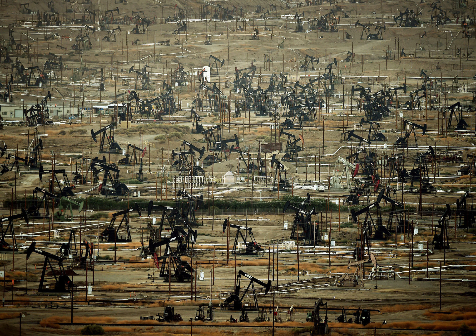
Day 85, Thu, 3/23: Having never been to Bakersfield, we planned 2 nights here. Kern County is one of the largest agricultural regions in the world. It is the most diverse and productive farming area in the world with some 250 different crops than include 30 varieties of fruits and nuts, 40 types of vegetables, and 20 different field crops. It is also known as the oil capitol of California. It is the most productive oil-producing county in the country. Bakersfield is also the birthplace of country music known as the "Bakersfield Sound", a genre of country music created in the mid to late 1950s by artists like Buck Owens and Merle Haggard.
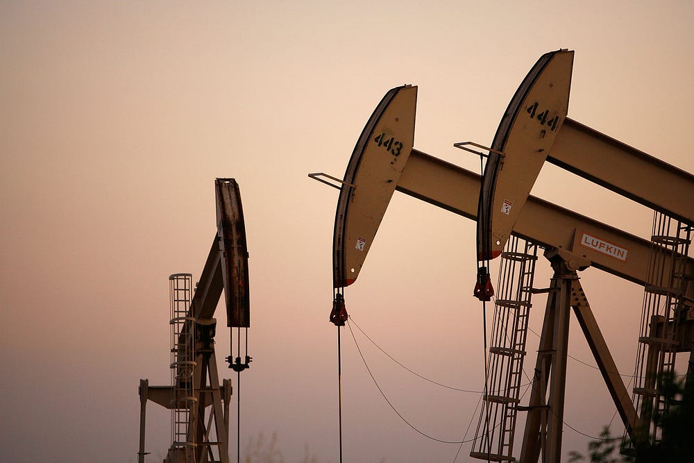
In Bakersfield it doesn't take long to get into the country. There's no sprawl. The city is pretty much contained and agriculture and oil fields surround it. Our drive took us through beautiful farmland to Panorama Drive that follows the scenic Kern River. Of course we stopped to check out the golf course and county park along the way. As we got closer to the city, on the north bank of the Kern River was miles and miles of barren land occupied by oil derricks called Oil City. Although agriculture is a big business in Kern County, oil is even bigger. Kern County produces 50%-70% of the oil in California. In addition, there is cogeneration, which produces electricity as a by-product from steam used in the oil fields. Steam cogeneration from the oil fields produces much of the electricity used in both Kern and Los Angeles counties. It looks really ugly, but is quite a valuable resource.
Because this industry has such a huge employment impact on this area, it really gets hit hard with fluctuating crude oil prices. Thus, hiring and cut-backs spike frequently.

 |
| Kress Building |
We explored some historic buildings downtown and headed over to take a look at Buck Owen's $7 million Crystal Palace. It opened in 1996 as a performance venue for country western music and still draws big name entertainers. The Crystal Palace was designed in the Western Revival style, a style that resembles buildings from the 19th century American Old West. The interior resembles an American western town from that same period. There is also a museum with Buck Owen's memorabilia including his 1972 Pontiac mounted behind the bar. Unfortunately it didn't open until 5pm and we didn't want to kill over an hour, so continued on with our drive. Interesting day, but we don't need to do Bakersfield again.
 |
| Fox Theater |
 |
| Crystal Palace |
 |
| Woolworth Building |


Day 86, Fri, 3/24: Today we drove our entire trip to Lodi on Hwy 99. What a beautiful drive! We passed through small farm towns, vineyards, orchards, and crossed over many flooded rivers and creeks. The road was good. We really had very little traffic to speak of. Quite a nice change from travelling I-5 and we thoroughly enjoyed it. We pulled into a very crowded Flag City RV Park mid-afternoon. It's a lovely park, well run and organized. It is fairly close to I-5, but we didn't really notice the noise. A background buzz at night, but nothing we couldn't live with.
Because we'd come from the east, we saw a few of the vineyards and wineries on our way to the park. One was just a mile down the street, so once we got set up, we headed to Michael David Winery for some tastings. In addition to the wine tasting room, the facility also has a Farm Cafe, retail store and bakery (yahoo!). Like most wineries, they produce wines under different labels, the "7 Deadly Zins" probably being the most recognizable and available at retail wine locations. We tried a sampling of whites and reds. Lodi produces more wine grapes than any other California Appellation, so that's why we're here for 3 nights. There are more than 85 wineries in and around Lodi, producing some 450 labels. Old vine zinfandel, cabernet sauvignon, merlot and chardonnay are specialties from this region. Looking forward to the weekend.
Day 87, Sat, 3/25: We started our morning with a good farm breakfast at Michael David Winery. They serve homestyle American classics with a focus on seasonal, local produce. We hardly eat breakfast out, so this was a real treat. I had a benedict that had fresh spinach and a Chardonnay cream sauce on top. It was delicious. After breakfast, we headed downtown. I'd picked up a brochure at the resort office and discovered that Lodi had a walking mural tour. Had to do that, besides it's good exercise. The story of the murals began in 2006 when the Head West Walldog Committee gathered 100 artists from all over the United States and Canada in Lodi to paint historically themed murals. The artists known as Walldogs (http://thewalldogs.com), designed and crafted pictures as a gift to the community, celebrating the 100th anniversary of the City's incorporation. The murals reflected Lodi California and it's agricultural heritage. The Walldog are members of the Letterheads, an organization of graphic designers, illustrators, and sign artists (https://en.wikipedia.org/wiki/Letterheads). With map in hand, we walked downtown Lodi to see the 11 murals:


 |
| 1907 Mission Revival-style Ceremonial Arch |
 |
| Lodi Arch |
 |
| New "1952 retro" McDonalds downtown Lodi |
 |
| Lodi Historic Amtrak Station |
In the afternoon we headed west on Hwy 12 toward the California Delta area, an inland river delta and estuary formed by the merger of the San Joaquin and Sacramento Rivers. The Delta estuary is the largest on the west coast of North America, covering more than 40% of California. An estimated 25% of all warm water and anadromous sport fishing species; 80% of the state's commercial fishery species live in or migrate through the Delta. At least half of its Pacific Flyway migratory water birds rely on the region's wetlands. Since the mid-19th century, most of the region has been gradually claimed for agriculture. Due to wind erosion and oxidation, much of the Delta region sits below sea level, behind levees (like Holland). The levees are quite effective at keeping the rivers separated from agriculture, but levees do fail (called breaches) and can cause serious and permanent damage. Much of the water supply for central and southern California is taken from this area via pumps located at the southern end of the Delta. It is used for irrigation in the San Joaquin Valley and municipal water supply for southern California. The Sacramento River Deep Water Ship Channel connects the Delta to the Port of Sacramento. For more than 30 years, the Delta has been embroiled in continuing legal controversy over the struggle to restore the faltering ecosystem while maintaining its role as the hub of the state’s water supply. It's a beautiful area but has become quite a political and environmental hotspot.

We'd been to the northern part of the Delta when we were in Sacramento last fall, so we were curious how this area would be different. With all the rains California got this year, there was lots of flooding. Many farmlands were under water. We crossed the Mokelumne River and then turned south on Hwy 160 at Rio Rico heading down Brannon Island and Sherman Island toward Oakley. There are lots of lift bridges in this area and we crossed one at 3 Mile Slough. We were now driving on top of the levee on a narrow 2-lane country road.
We had a good view of the river on the right and the farmland or bogs on the left and wanted a leisurely drive, but the locals kept coming up on our tail or passing us at speeds not appropriate for the road. This area of the Delta is a huge sport fishing area and we saw lots of small marinas along the river advertising their services. This is also a big wind surfing area as the river widens at the south, but we didn't see any this trip. As we got closer to Antioch and Oakley, we could see the Antioch Bridge in the distance. It's an unusual looking bridge because it has no visible supports above the bridge and doesn't even look like it has very high sides. Unusual for a bridge this size, it's one lane in each direction (toll going northbound).
 |
| Lift bridge |
 |
| 3 Mile Slough Bridge |
 |
| Antioch bridge |
We drove into Oakley, hoping for a spot we could access the Delta for a walk. We stumbled upon Big Break Regional Park. The park was named for the break in the levee system that flooded an asparagus farm in 1928. The break formed a small bay along the river, near the area where fresh water from the river mixes with salt water from San Francisco Bay. Big Break Regional Shoreline provides habitat for at least 70 species of birds and several special of mammals. The park has a Visitor Center that features a natural history museum, science laboratory, and staging area for paddling and hiking trips along the Delta rivers. There is also an outdoor educational area for explaining the ecosystems and wildlife of the Delta region. We spent quite a bit of time in the Visitor Center and then headed out for a walk on one of the trails down to the water.
Day 88, Sun, 3/26: Yeah! Today is wineries day! I spent the morning looking at all the wineries on the internet and picked the ones that sounded the most interesting, either for architecture, setting, or wine specialty. We really enjoy going to wineries that have some history, unusual architectural or setting, or have specialized wines. We don't eliminate wineries because we're not wine snobs, and often don't even do wine tasting. Sometimes we just wander the grounds and take pictures. We started the day at Heritage Oak because it said it had wine tasting, fruit stand and a bakery. We thought 11am might be a little too early for wine tasting....but if they had a bakery, that's worth the stop. Unfortunately, it's off season and they weren't geared up in either the fruit stand or bakery, so we found a soup mix in their shop and bought that for dinner the next night. Next stop in the vicinity was Durst Winery. We got there about 11:30 and found out they didn't open until 12n. Oh well, Woodbridge is just down the road so we headed there. Nothing special about this place except it's huugge. You see the facility from a long distance. Storage tanks and large buildings dot the property set among the vines. This is Woodbridge by Robert Mondavi..they're one of the bigger players in this area. The tasting room was in an old stucco house with a nice outside patio for wine on a warm summer day. Nothing special, but the people were nice and they let us taste some wines that were only available at the winery. Of course, I bought one.
 |
| Tasting Room |
 |
| Woodbridge from distance |
Next stop was St. Jorge. I picked this one for it's architecture...Mediterranean. Come to find out, they specialize in Portuguese wines. The tasting room was dark and cozy with a wood fire blazing in the fireplace and decorated with a baby grand piano and artwork by the owners' daughter (she also designed the labels for the wine). Some of the wines were paired with food: cheese, Portuguese sweetbread, chocolate. Very friendly people and it wasn't crowded, so we visited for a while. Bought a bottle of Tempranillo.
 |
| St. Jorge Winery |
 |
| St. Jorge Winery |
 |
| St. Jorge Tasting Room |
 |
| St. Jorge Tasting Room |
 |
| St. Jorge Winery |
There was lots of flooding in this area so we saw many vineyards under water. Surprisingly, we were told this isn't harmful...gives those vines a good drink of water. The specialty in this region is Old Vine Zinfandel. We were surprised to learn that these vines don't need any support. They have very sturdy trunks and stand on their own, growing more like a tree.
Our next winery was just down the street from St. Jorge - Viaggio. I looked at the pictures online and this place looked more like something in Napa...the large villa look. Big wedding venue. The parking lot had lots of cars, unlike most we'd been to so far. Looked promising.
The tasting room/restaurant was packed! Live music. Now this is our kind of place. Rather than do wine tasting, we ordered a glass of wine and one of their pizzas and went to sit out on the patio (not warm, but comfortable with a light jacket). We saw there was a table open inside, so moved in where we could see the band. It was just 2 guys, but there were really good and played a good variety of different types of music. It took forever for our pizza, so we ordered another glass of wine. We were having such a good time we really didn't want to leave, but 2 glasses of wine was enough.
 |
| Viaggio Wedding Staircase |
 |
| Viaggio Wedding Staircase under water |
 |
| Viaggio Tasting Room/Restaurant |
 |
| Live Music |


This was out last night and we'd planned to eat at one of two restaurants located in old buildings downtown: the Dancing Fox or the Lodi Beer Company. We weren't particularly hungry and certainly didn't need any more wine or beer, but thought we'd stop in the Dancing Fox for dessert. They closed at 3pm on Sunday..odd. We walked to the Lodi Beer Company on the next block and ordered some great desserts. Cute place.

 Day 89, Mon, 3/27: Moving day again. Nothing too eventful this day. It was a boring drive up I-5 (even clear sailing over Siskiyou Pass) to Southern Oregon RV Park in Central Point (north of Medford) Oregon for one night. This is a brand new park on the grounds of the Jackson County Expo Park. It's near I-5, but the freeway noise was tolerable (maybe we're just getting used to it???). The park is very nice with all pull thrus, wide spaces, grass, a lake for fishing and nice new shiny restrooms. The registration center is not quite open yet (that means no WiFi yet too) but they looked like they were getting close to completion. The pay system right now is cash in an envelope at the entrance, so you need to know that in advance. We were only there for one night but would stop again...though next time it will be more crowded.
Day 90, Tue, 3/28: Another boring drive up I-5 to Phaesant Ridge RV Park in Wilsonville, Or. This is a very crowded park with narrow sharp drives, but it's a nice park and great location in the middle of Wilsonville (Oregon wine country). The place was full. Lucky us. Tomorrow they are connecting WiFi at the sites!!!!!
We discovered they had a McMenamins in an old church in the historic district of Wilsonville and decided to check it out. The restaurant was in a building in the back of the old church so we stopped there for a beer. The waitress told us the main floor of the church is used as an event venue....and tonight they were having a historical speaker on Bootlegging in Oregon. We decided to give it a try. Tables and chairs were set up schoolroom fashion....first come, first served for seating. Order off the menu. What a hoot!
Join Finn J.D. John for an exciting presentation exploring the adventure, romance, comedy and tragedy of Oregon's Second-Oldest Profession. From Canadian rumrunners in high-powered speedboats, to vice-squad cops supplying the mayor with confiscated Scotch, the undercover booze barons of the Beaver State worked tirelessly throughout the '20s to keep the West Coast's thirst slaked.

 |
| The church set up for the speaker |
 |
| Restaurant |
 |
| Light Fixtures at the restaurant |
 |
| Light fixtures at the restaurant |
 |
| Restaurant |
 |
| Dave at the restaurant |
Day 91, Wed, 3/29: The forecast for today: wind and rain. Welcome home. We started our day at Biscuit Cafe (actually I guess it wasn't the start of our day because we had breakfast for lunch at 11:30). The food was excellent. The waitress told us Biscuit Cafe is a franchise and we saw a couple of them on our travels. After lunch, we took a rainy drive along the south side of the swollen Willamette River. Pretty drive, but not a good day for photos. One of our destinations to check out was Champoeg State Heritage Area (State Park with Camping). Friends have RVd here so we thought we should check it out. The park features a unique combination of history, nature and recreation. This is the site where Oregon's first provisional government was formed by a historical vote in 1843. The park's visitor center, Newell House and Pioneer Mothers Log Cabin museums, historic Butteville Store are all part of the history of the pioneer town of Champoeg. The park is situated on the south bank of the Willamette River so portions were flooded. Lots of huge trees. It might have looked nicer on a sunny day, but today everything was pretty soggy.

We continued our drive to Dundee (wine country) but didn't stop. The town didn't look very inviting, but there are tons of wineries in the surrounding hills. The weather was wet, there was lots of traffic with construction and we were tired of driving. We found our way back to Wilsonville driving the north side of the Willamette River. It was a pretty drive thru orchards, vineyards, horse ranches and huge mansions (close to town) but the road was very narrow and winding. We stopped at Fred Meyer (yes! back in Freddy territory) on the way home. Look what was camped in the space in front of us when we got back:
Everything in the world was hanging from it. We couldn't quite figure out what it was. Looked like a converted taco wagon. Obviously this park doesn't care. Curious what it looks like driving down the freeway.
Day 92, Thu, 3/30: Happy Birthday to me. This is a biggie...I mean a real biggie! It was cool, but the sun was shining. Heading to McMinnville (more wine country) for some more wine tasting. Many of the tasting rooms in this area are downtown. Rather than retrace our previous routes west, we went south to Salem and took a country drive to McMinnville. We drove thru lots of farmland and vineyards and with the sun shining, the hillsides were really beautiful.
 We got to town about noon, but we'd stopped at Starbucks for a late breakfast on our way, so we weren't hungry for lunch. We wandered around McMinnville's main street, poking our noses in small shops and eyeing menus at the many nummy-looking downtown restaurants. Our first winery for tasting was Naked. They have vineyards all over Oregon and Washington and are based out of Hood River. They produce both reds and whites including Pinoir Noir, Barbera, Chardonnay and Muscat. They have also developed a line of Outdoor Vino that comes in a plastic bottle. Dave was intrigued by that one. Next stop was Eola Hills Wine Cellars. Located in the historic McMinnville Mercantile Building, Eola Winery offered a wide variety of blends, varietals and dessert wines as well as their famous Pinot Noir, Merlot, Zinfindel and Riesling. The fellow working at the winery was anxious for customers and someone to talk to. Though we only paid for one tasting, he gave Dave a couple free tastes of two of their Zinfindels. We spent quite a bit of time there just visiting. A few blocks from the central core of downtown is the Granary District which houses more wine tasting rooms, brew pubs and restaurants. First stop there was Elizabeth Chambers Cellar, housed in the power company's old power house. Built in 1926, the brick building provided energy to the community for decades, powered by 3 diesel electric generators. We wandered into the the tasting room. It still had the the industrial feel from its previous life, but updated. We just wanted to see the building, so didn't do a tasting.


We poked our noses in one of the breweries in the Granary District. Didn't stop for a beer, but did tour the building.
On our way back to the car, we passed lots of people with ice cream cones. Now we were hungry but didn't want to spoil our dinner, so we stopped for one scoop. Ooh it tasted good. We wandered our way back to Wilsonville for a really good birthday dinner at the Oswego Grill. What a nice day.
 Day 93, Fri, 3/31: We couldn't decide what to do on our last day in the area, and finally decided on a road trip to Oregon City to go to the End Of The Trail Museum. We've been to the Oregon Trail Museum in Baker, but couldn't remember that we'd been to this museum in Oregon City (we said we were going to feel really stupid if when we got there we realized we'd already been there). Anyway, we took the backroads north to Oregon City and did some exploring before heading to the museum. The city park on the Willamette River that offered RV parking was completely under water.


The next stop was the museum. We both remember driving to the museum before, but (whew!) we haven't been inside. The museum is designed around the shape of a line of 3 covered wagons. At the entrance, you are viewing memorabelia and historical facts about
 the settlers leaving from the Missouri side of the trail. There are lots of interactive displays for children like loading a replica wagon, playing games that children of the time played, churning butter, dressing in period clothes and making candles. In the center of the museum is a large theater that features an excellent film narrated by Dr. John McLoughlin, the founder of the Hudson's Bay Company, and tells a very descriptive tale of the settlers and their struggle to get to Oregon. The final building houses information and replicas of life in Oregon (for those that survived the journey).
Oregon City was established by the Hudson's Bay Company in 1829. It was strategically situated at the confluence of the Clakamas and Willamette rivers to take advantage of the power to run a lumber mill. It was the capital of the Oregon Territory from 1848 until 1851. It was the last stop on the Oregon trail and a destination for those wanting to file land claims upon arrival. Today, the city center remains part of its historic character with the preservation of houses and other buildings from the era of the city's founding.
 We drove to the overlook to see the overflowing Willamette River spill over the falls.
We stopped in downtown for lunch and picked a restaurant called "The Verdict", located across the street from the Clackamas County Courthouse. Located in the basement level of one of Oregon's commercial buildings built in 1848, it was decorated in a lawyer/legal theme with shelves of law books, bars on the windows, fringed drapery, and brick with dark heavy woodwork. It really was a cute place with good food and good service.


After lunch we needed a walk, so headed to the Municipal Elevator of Oregon City. The city is 2 levels, the river level and the bluff. In the early early years 722 steps were built to connect the two sections of town. In 1912, the city voted to install a public elevator to replace the stairs. The steel and wood 89-foot elevator, operated by either electricity or water power, was completed in 1915. Once at the top, it was necessary to cross adangerous 35-foot catwalk over the rail tracks. In 1924 the hydraulic power was replaced by electricity. A new 130-foot elevator was built in 1955 to replace the failing wooden structure. A 35-foot long tunnel was constructed under the tracks on the lower street level to eliminate the need for the catwalk at the top of the elevator. The Oregon City Municipal Elevator operates as one of 4 municipal elevators in the world and "Elevator Street" remains the only "vertical street" in North America.
Once at the top, there is a paved trail along the bluff that we followed toward the falls. Different view of the falls from here.
 |
| Oregon City Architecture |
 |
| Oregon City Mural |
Day 94, Sat, 4/1: Home. Another adventure comes to an end (for now).
 Day 63, Wed, 3/1: Today
was a good day to head to White Tank Mountain Regional Park. The temps were in the mid-70s and the sky was
clear blue. The 4,000’ high White Tank
Mountains separate the Phoenix Basin of the Salt River Valley from the
Hassayampa Plain. Floodwaters have
gouged out a series of depressions, or “tanks”, in the white granite rock, thus
the name of the mountains. The regional park had many hiking trails, but based on the fact that we’d recently had so much rain, we opted for the Waterfall Canyon Trail.
Day 63, Wed, 3/1: Today
was a good day to head to White Tank Mountain Regional Park. The temps were in the mid-70s and the sky was
clear blue. The 4,000’ high White Tank
Mountains separate the Phoenix Basin of the Salt River Valley from the
Hassayampa Plain. Floodwaters have
gouged out a series of depressions, or “tanks”, in the white granite rock, thus
the name of the mountains. The regional park had many hiking trails, but based on the fact that we’d recently had so much rain, we opted for the Waterfall Canyon Trail. 

 Most of the year the falls are dry, but after
a rain the falls pour into pools below and often overflow onto the narrow rock
steps leading the last few feet to the viewpoint. Fed by 2 upper waterfalls (off limits), the
lower falls are about a 2 mile round trip hike.
The well-traveled trail starts out flat and wide with a gradual slope
to a single lane rocky path at the top.
It’s very accessible to children and elderly (that’s us) and we passed
lots of each. There were information signs
along the way pointing out flora and fauna as well as two sites to observe
petroglyphs. Glad we did this hike when
it
Most of the year the falls are dry, but after
a rain the falls pour into pools below and often overflow onto the narrow rock
steps leading the last few feet to the viewpoint. Fed by 2 upper waterfalls (off limits), the
lower falls are about a 2 mile round trip hike.
The well-traveled trail starts out flat and wide with a gradual slope
to a single lane rocky path at the top.
It’s very accessible to children and elderly (that’s us) and we passed
lots of each. There were information signs
along the way pointing out flora and fauna as well as two sites to observe
petroglyphs. Glad we did this hike when
it 


 On the way home we decided to do some exploring. We stopped at the Wrigley Mansion (yup, the chewing gum magnate). William Wrigley, Jr built the landmark building between 1929 and 1931 at a cost of $1.2 million. It was a compilation of many architectural styles, but strongly Spanish Colonial, as reflected in the extensive use of tile throughout. The mansion sits atop a 100 foot hill that overlooks greater Phoenix and the Arizona Biltmore Hotel, which Wrigley also owned. The Phoenix mansion was just one of 7 residences owned by the Wrigleys, but the smallest and only used a few weeks a year. William Wrigley died in 1932, shortly after its completion. In 1992 Geordie Hormel (of Hormel Foods family) purchased the mansion and turned it into an event venue for meetings, conventions and weddings. He was a musician and recording studio proprietor, so the facility was frequently used. Due to zoning regulation, The Wrigley Mansion operates as a private club (more on that later). Though not particularly elaborate on the outside, the mansion is quite opulent inside with inlay wood ceilings, personalized tiles (Mr. Wrigley had his own tile company), hand carved doors, handmade tapestries and crystal chandeliers. There are pictures throughout of Hollywood Stars and political celebrities being entertained at the mansion. It must have been quite a place to be seen in it's day. We got there late enough in the day that we missed the last organized tour. We were told that for $5.00 each we could walk through the mansion on our own or if we'd rather, we could purchase a drink from the bar and wander the mansion with drink in hand (the advantages of a private club). Off we went to the bar. We got there just as there was a bartender shift change. We started chatting with the retiring bartender as he poured our wine and before you know it he said "follow me" and proceeded to give us a personalized tour of the mansion (pretty sweet deal). We even saw the old switchboard for the mansion that was wallpapered in gum wrappers. There was a wedding getting started as we left, so we skirted around the edges of the lawn to get back to the car. Pretty interesting place.


 Day 70,
Wed, 3/8: Today was the fun day that made us alter
our travel plans. This was the Bill Hilton golf tournament
for all the folks from Trilogy that winter in Arizona. We played a private Sun City course in west
Sun City called Corte Bella. A beautiful
course with wide fairways, virtually no water, and lots and lots of
bunkers.
Day 70,
Wed, 3/8: Today was the fun day that made us alter
our travel plans. This was the Bill Hilton golf tournament
for all the folks from Trilogy that winter in Arizona. We played a private Sun City course in west
Sun City called Corte Bella. A beautiful
course with wide fairways, virtually no water, and lots and lots of
bunkers. 


 Day 71,
Thu, 3/9: Moving day! South to Voyager RV Resort in south Tucson. We hadn’t stayed at Voyager before, but had
friends that did. Thought we’d try it
out. Hmmm….not nearly as nice as the
park in Phoenix. It was not anywhere
near full, but for whatever reason, we got a space with neighbors all around. It was a good sized space with plenty of room
to put out the slides, a concrete pad with gravel surround to park the car
alongside.
Day 71,
Thu, 3/9: Moving day! South to Voyager RV Resort in south Tucson. We hadn’t stayed at Voyager before, but had
friends that did. Thought we’d try it
out. Hmmm….not nearly as nice as the
park in Phoenix. It was not anywhere
near full, but for whatever reason, we got a space with neighbors all around. It was a good sized space with plenty of room
to put out the slides, a concrete pad with gravel surround to park the car
alongside. 


 Day 74,
Sun, 3/12: Our trek today was to Sabino Canyon for
a little hiking in the desert. Today was
the hottest day yet and we got a late start.
We got to the park entrance about 9:30 and the main parking lot was
already full (not sure what we were thinking…we’re retired…should be doing this
on a weekday). We went to overflow
parking and hiked ¼ mile on a dirt trail to the main trail/road. The park service offeres a 45-minute, 3.8
mile narrated tram tour from the Visitors Center. The tram makes 9 stops along the tour at
various trailheads and turns around at stop #9, heading back to the Visitors
Center. Many people take the tram to the
end and hike back down the paved road to the Visitors Center. Of course, the trail we took from the parking
lot did not drop us at the Visitors Center, but part way up the road. We weren’t expecting a hike on a paved road,
but it was hot and we decided with the heat, we probably weren’t going very far
anyway.
Day 74,
Sun, 3/12: Our trek today was to Sabino Canyon for
a little hiking in the desert. Today was
the hottest day yet and we got a late start.
We got to the park entrance about 9:30 and the main parking lot was
already full (not sure what we were thinking…we’re retired…should be doing this
on a weekday). We went to overflow
parking and hiked ¼ mile on a dirt trail to the main trail/road. The park service offeres a 45-minute, 3.8
mile narrated tram tour from the Visitors Center. The tram makes 9 stops along the tour at
various trailheads and turns around at stop #9, heading back to the Visitors
Center. Many people take the tram to the
end and hike back down the paved road to the Visitors Center. Of course, the trail we took from the parking
lot did not drop us at the Visitors Center, but part way up the road. We weren’t expecting a hike on a paved road,
but it was hot and we decided with the heat, we probably weren’t going very far
anyway. 

 The road followed the Sabino
River and there were spots you could hike down to the river for a shady
detour. At various points along the
route were easy to challenging trailheads off into the desert. The main road was all paved, 2,000 to 3,300
feet elevation and crossed Sabino Canyon over 9 stone bridges. We walked the trail for about an hour and
turned around and headed back to the parking lot before melting. It was really getting hot quickly (90+ degrees). Found a great little lunch place called Bread
and More for lunch, stopped for groceries and headed home to hit the pool.
The road followed the Sabino
River and there were spots you could hike down to the river for a shady
detour. At various points along the
route were easy to challenging trailheads off into the desert. The main road was all paved, 2,000 to 3,300
feet elevation and crossed Sabino Canyon over 9 stone bridges. We walked the trail for about an hour and
turned around and headed back to the parking lot before melting. It was really getting hot quickly (90+ degrees). Found a great little lunch place called Bread
and More for lunch, stopped for groceries and headed home to hit the pool.

 Day 75,
Mon, 3/13: Before we left, I discovered through one of my art sites that the city of Tucson had a city-wide mural display. Sounded like a wonderful way to spend the day. The City of Tucson started a pilot program in
2016 called the City of Tucson Mural Program.
The program was created to beautify blighted areas, strengthen the local
culture, and provide a visually friendly environment for residents and visitors. The initial funding for the program came from a generous $50,000 grant from the Tohno O'odham Nation. Additional funds were donated by local
businesses and individuals to create murals that reflect diversity in
style and culture and artists from diverse backgrounds were encouraged to
apply. Today the City of Tucson Mural
Program consists of over 500 murals across north, central and south Tucson
created by local artists. The 7 map areas have diagrammed and listed the address of each mural (tucsonmurals.org). After I printed each of the maps, it was pretty clear that we would only be viewing a small fraction of the murals. They are spread out all over the city. It was going to be another 90+ day, so we started out early. We began our tour by starting on the south edge of downtown and trying to view the murals by car. That didn't work because many of the murals are on the side or back of buildings. Some buildings didn't have noticeable addresses on them. We quickly gave up that plan and selected a number of murals in the downtown core, parked and headed out on foot.
Day 75,
Mon, 3/13: Before we left, I discovered through one of my art sites that the city of Tucson had a city-wide mural display. Sounded like a wonderful way to spend the day. The City of Tucson started a pilot program in
2016 called the City of Tucson Mural Program.
The program was created to beautify blighted areas, strengthen the local
culture, and provide a visually friendly environment for residents and visitors. The initial funding for the program came from a generous $50,000 grant from the Tohno O'odham Nation. Additional funds were donated by local
businesses and individuals to create murals that reflect diversity in
style and culture and artists from diverse backgrounds were encouraged to
apply. Today the City of Tucson Mural
Program consists of over 500 murals across north, central and south Tucson
created by local artists. The 7 map areas have diagrammed and listed the address of each mural (tucsonmurals.org). After I printed each of the maps, it was pretty clear that we would only be viewing a small fraction of the murals. They are spread out all over the city. It was going to be another 90+ day, so we started out early. We began our tour by starting on the south edge of downtown and trying to view the murals by car. That didn't work because many of the murals are on the side or back of buildings. Some buildings didn't have noticeable addresses on them. We quickly gave up that plan and selected a number of murals in the downtown core, parked and headed out on foot.


 Day 82, Mon, 3/20: Dave and I took off for the day to explore the drive south from Lake Havasu to Parker. We drove this road north to get to the park, and noticed all kinds of RV parks and restaurants along the water. We wanted to check them out to see if they might be future options if we should come this way again. Our first stop was to visit Parker Dam. Parker Dam is a concrete arch-gravity dam that crosses the Colorado River 155 miles downstream from Hoover Dam and creates Lake Havasu. It was built between 1934 and 1938 and is 320 feet high, 235 feet of which are below the riverbed, making it the deepest dam in the world. We then proceeded to work our way down the Arizona side of the river, exploring RV parks and resorts. Our original plan was to have lunch on the river, but we had a late breakfast and neither of us was hungry, so we just kept driving. The drive from Havasu to Parker doesn't take long. It's only about 35 miles without all the sightseeing. When we got to Parker, we went across the bridge to the California side of the river and headed back toward the dam. This side of the river was dotted with RV and mobile home parks too, but not quite as populated. It looked like much of the land was BLM and we kept seeing signs to watch out for wild burrows. Wow! Would we some? Sure enough, we saw quite a few. They took their time crossing the road or would stand still in the center and stare at you. Pretty mangy, but cute (even a baby).


 We heard horror stories from RV friends about travelling over Tehachapi Pass. The winds can be ferocious (thus the wind turbines). It was somewhat windy over the pass, but nothing worse than we've experienced before. The bad part was when on a windy stretch, a large truck passed. Thankfully that didn't happen too often. The worst part of the trip was the downhill off the pass into Bakersfield. Radar showed reports of thunderstorms at the summit and we saw some good lightning, but then the rains came!...and the hail!...lots of hail and really strong wind! We finally pulled over to let the cell pass because the road was so slick. Icky! We made it to Orange Grove RV Park safe and sound. Pretty park in the middle of an orange grove, but way too close to the rail line. We could tolerate the freeway in the distance, but the frequent train whistle at multiple crossings was way too loud. Even the white noise machine wouldn't drown it out. Probably won't stay here again.


 We discovered they had a McMenamins in an old church in the historic district of Wilsonville and decided to check it out. The restaurant was in a building in the back of the old church so we stopped there for a beer. The waitress told us the main floor of the church is used as an event venue....and tonight they were having a historical speaker on Bootlegging in Oregon. We decided to give it a try. Tables and chairs were set up schoolroom fashion....first come, first served for seating. Order off the menu. What a hoot!


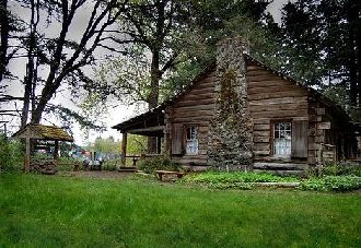


 We got to town about noon, but we'd stopped at Starbucks for a late breakfast on our way, so we weren't hungry for lunch. We wandered around McMinnville's main street, poking our noses in small shops and eyeing menus at the many nummy-looking downtown restaurants. Our first winery for tasting was Naked. They have vineyards all over Oregon and Washington and are based out of Hood River. They produce both reds and whites including Pinoir Noir, Barbera, Chardonnay and Muscat. They have also developed a line of Outdoor Vino that comes in a plastic bottle. Dave was intrigued by that one. Next stop was Eola Hills Wine Cellars. Located in the historic McMinnville Mercantile Building, Eola Winery offered a wide variety of blends, varietals and dessert wines as well as their famous Pinot Noir, Merlot, Zinfindel and Riesling. The fellow working at the winery was anxious for customers and someone to talk to. Though we only paid for one tasting, he gave Dave a couple free tastes of two of their Zinfindels. We spent quite a bit of time there just visiting. A few blocks from the central core of downtown is the Granary District which houses more wine tasting rooms, brew pubs and restaurants. First stop there was Elizabeth Chambers Cellar, housed in the power company's old power house. Built in 1926, the brick building provided energy to the community for decades, powered by 3 diesel electric generators. We wandered into the the tasting room. It still had the the industrial feel from its previous life, but updated. We just wanted to see the building, so didn't do a tasting.
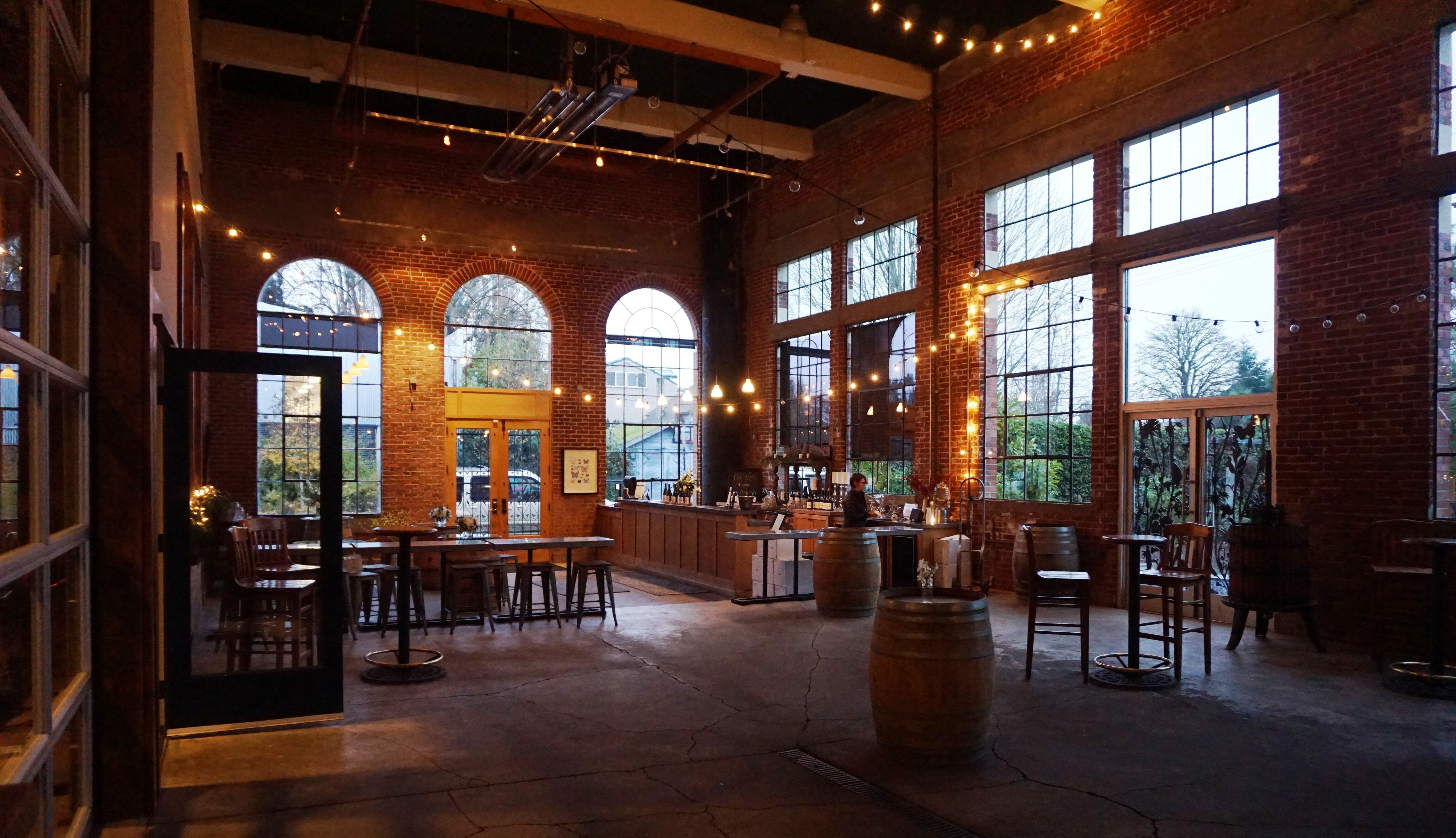

 Day 93, Fri, 3/31: We couldn't decide what to do on our last day in the area, and finally decided on a road trip to Oregon City to go to the End Of The Trail Museum. We've been to the Oregon Trail Museum in Baker, but couldn't remember that we'd been to this museum in Oregon City (we said we were going to feel really stupid if when we got there we realized we'd already been there). Anyway, we took the backroads north to Oregon City and did some exploring before heading to the museum. The city park on the Willamette River that offered RV parking was completely under water.


 the settlers leaving from the Missouri side of the trail. There are lots of interactive displays for children like loading a replica wagon, playing games that children of the time played, churning butter, dressing in period clothes and making candles. In the center of the museum is a large theater that features an excellent film narrated by Dr. John McLoughlin, the founder of the Hudson's Bay Company, and tells a very descriptive tale of the settlers and their struggle to get to Oregon. The final building houses information and replicas of life in Oregon (for those that survived the journey).
 We drove to the overlook to see the overflowing Willamette River spill over the falls.


